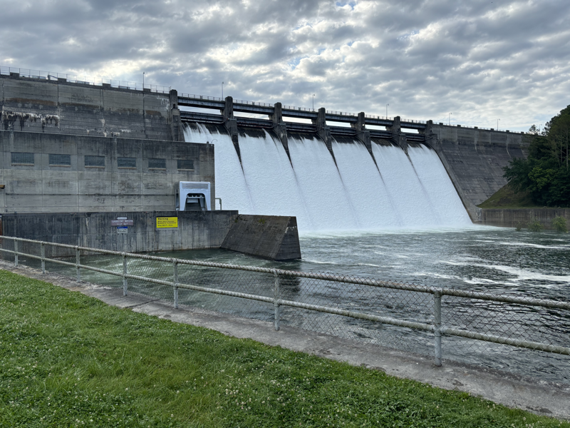
Rainfall total 7” ahead of schedule; Dale Hollow nearing normal levels
Foot of rain fell in Clay in May
CELINA-Despite a year-to-date rainfall total running well ahead of schedule and right at a foot falling here in May, Dale Hollow Lake is nearing a normal summertime elevation following around-the-clock generation and spillways being opened earlier this month for only the 11th time in 70 years.
The U.S. Army Corps of Engineers took action after the reservoir’s elevation rose four feet above the normal summer pool of 651 feet above sea level (FASL), and their response had the lake back down near that mark as of HORIZON press time Monday.
With 11.87 inches recorded here inside the city limits and 12.68 inches documented near Hermitage Springs by local Community Collaborative Rain, Hail and Snow Network (CoCoRaHS) weather stations, Clay County’s one-foot average more than doubled the just over five-inch 30-year norm for May.
Last month’s total surged year-to-date numbers over seven inches above the 26 inches normally seen by mid-June, as the current total for 2024 sat at 33.41 inches here and 33.10 inches in the west end of the county.
National Weather Service statistics show the annual precipitation average here is 55.28 inches.
December is the wettest month on average at 5.48 inches, with July following closely behind at 5.36 inches. Add March, April, May, and June to July, and there is a five-month period where at least five inches of rain falls consecutively each month.
November (3.63”) and October (3.60”) are the driest months on average.
Lake level
normalizes
After reaching a peak of 655 FASL, Dale Hollow Lake sat at 651.5 FASL in elevation Monday, and it was predicted to drop below summer pool by midweek, according to information found online at tva.com/environment/lake-levels/dale-hollow.
The quick reduction in elevation was a product of spillway gates being opened for only the 11th time since 1953, though the occurrence has become more frequent since the turn of the century.
Water has now been spilled over the top of the spillways seven times in the last 15 years, after only seeing it happen four times prior in the 20th century.
The recent trend began in 2009, when it had been 20 years since the event happened, and the flood gates were also opened in 2010 and 2011—accounting for three consecutive years.
A pair of back-to-back years then followed seven years later in 2018 and 2019, before skipping a year to the opening of 2021.
The four other times came in 1989, 1984, 1975, and 1962.
Dale Hollow’s historic peak of 660.98 FASL also came in 1975, and it’s all-time low of 631.1 FASL was set in 1956.
On average, Dale Hollow fluctuates from a springtime high of the low-650s to a wintertime low of 635 to 640 FASL or so, creating a less than 20-foot median range of the lake’s rise and fall.

